Twenty-five years ago today, four aircraft crossed the eastern...

Iain Cameron@theiaincameron
25 views
Sep 14, 2026
~2 min read
Advertisement
1
Twenty-five years ago today, four aircraft crossed the eastern United States and literally changed world politics.
But 9/11 was also a story very much shaped by geography as well as ideology: flight routes, fuel, cities, borders.
Here's some geography of 11 September 2001.
1/n
But 9/11 was also a story very much shaped by geography as well as ideology: flight routes, fuel, cities, borders.
Here's some geography of 11 September 2001.
1/n
2
The four hijacked flights all departed from the US East Coast and were bound for California.
Transcontinental aircraft carry large quantities of fuel, making them especially destructive once turned into weapons. The flight destinations were very much part of the planning.
2/n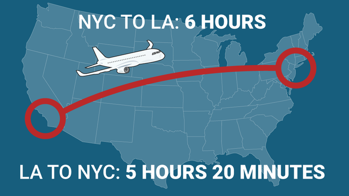
Transcontinental aircraft carry large quantities of fuel, making them especially destructive once turned into weapons. The flight destinations were very much part of the planning.
2/n
3
Two aircraft struck the World Trade Center in Lower Manhattan.
The location was part of its significance, too. Twin 110-storey towers rising from the southern tip of a narrow island, visible for miles across New York Harbour and the surrounding region.
Maximum propaganda.
3/n
The location was part of its significance, too. Twin 110-storey towers rising from the southern tip of a narrow island, visible for miles across New York Harbour and the surrounding region.
Maximum propaganda.
3/n
4
A third aircraft struck the Pentagon in Arlington, Virginia, just across the Potomac from Washington, D.C.
The fourth, United Flight 93, was also redirected towards Washington after being hijacked. Its probable target was the US Capitol.
4/n
The fourth, United Flight 93, was also redirected towards Washington after being hijacked. Its probable target was the US Capitol.
4/n
5
Flight 93 never reached Washington. After passengers and crew fought back, the hijackers crashed it near Shanksville, Pennsylvania.
A quiet piece of rural land, around 130 mi (210 km) northwest of Washington, became one of the defining locations of 9/11.
5/n
A quiet piece of rural land, around 130 mi (210 km) northwest of Washington, became one of the defining locations of 9/11.
5/n
6
Flight 93 had already travelled west as far as Ohio when it was hijacked. The aircraft was then turned southeast towards Washington.
Its final track therefore cut diagonally back across Pennsylvania, with the US Capitol only around 18 minutes’ flying time away when it crashed.
6/n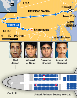
Its final track therefore cut diagonally back across Pennsylvania, with the US Capitol only around 18 minutes’ flying time away when it crashed.
6/n
7
Back in New York, geography created another problem.
With bridges and tunnels disrupted or closed, hundreds of thousands of people were, literally, stranded on Manhattan island.
The answer, little-known to many, came from the water surrounding the island.
7/n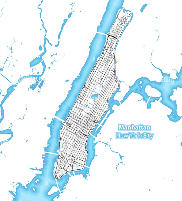
With bridges and tunnels disrupted or closed, hundreds of thousands of people were, literally, stranded on Manhattan island.
The answer, little-known to many, came from the water surrounding the island.
7/n
8
Ferries, tugboats, tour boats, and private vessels all converged on Lower Manhattan.
The US Coast Guard says more than 500,000 people were evacuated by water in under eight hours. One of the largest maritime evacuations in history.
8/n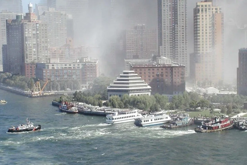
The US Coast Guard says more than 500,000 people were evacuated by water in under eight hours. One of the largest maritime evacuations in history.
8/n
9
When US airspace closed, geography suddenly made Newfoundland very important. Gander sits close to the great-circle routes linking Europe and North America.
38 aircraft carrying 6,656 people were diverted there, into a town of only around 10,000.
9/n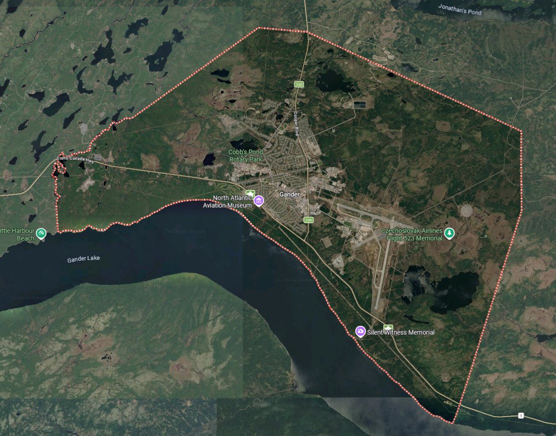

38 aircraft carrying 6,656 people were diverted there, into a town of only around 10,000.
9/n
10
The events of 9/11 are remembered, of course, through people and buildings. But they also unfolded across a map including Boston, New York, Washington, Pennsylvania, Newfoundland, and the Atlantic.
Geography shaped these attacks. It shaped the response, too, and - ultimately - where history was made.
/END
Geography shaped these attacks. It shaped the response, too, and - ultimately - where history was made.
/END
