Nano Banana Pro is a really good cartographer. Used it to turn low...

Bilawal Sidhu@bilawalsidhu
69 views
Nov 21, 2025
~2 min read
Advertisement
1
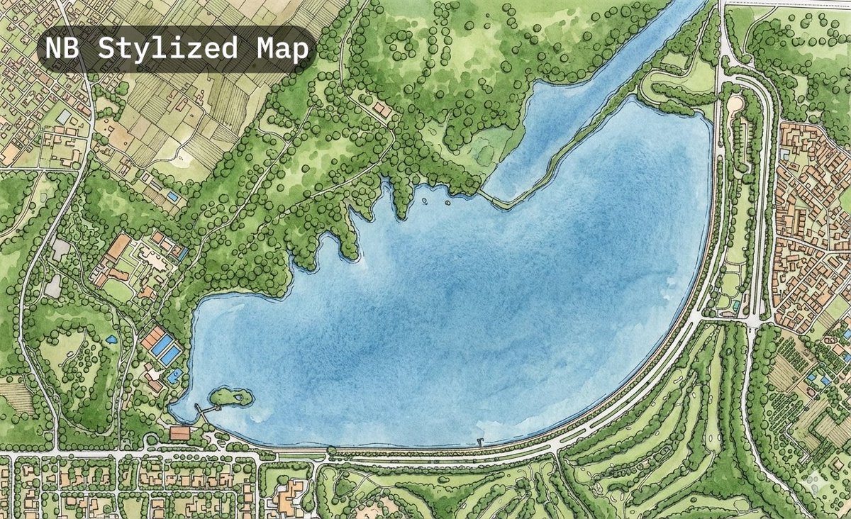
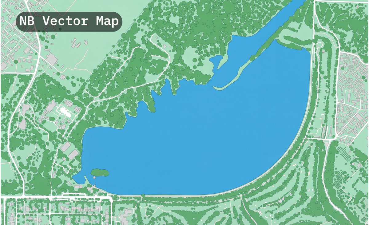
Nano Banana Pro is a really good cartographer. Used it to turn low res satellite imagery into a detailed hand drawn map and vector HD map.
Pretty wild how well it segments everything and even recovers paths/roads hidden under tree cover.
Looks way more detailed than the current google basemap which is pretty sparse in countries like India. Included both in video for comparison.
Pretty wild how well it segments everything and even recovers paths/roads hidden under tree cover.
Looks way more detailed than the current google basemap which is pretty sparse in countries like India. Included both in video for comparison.
0:10
2
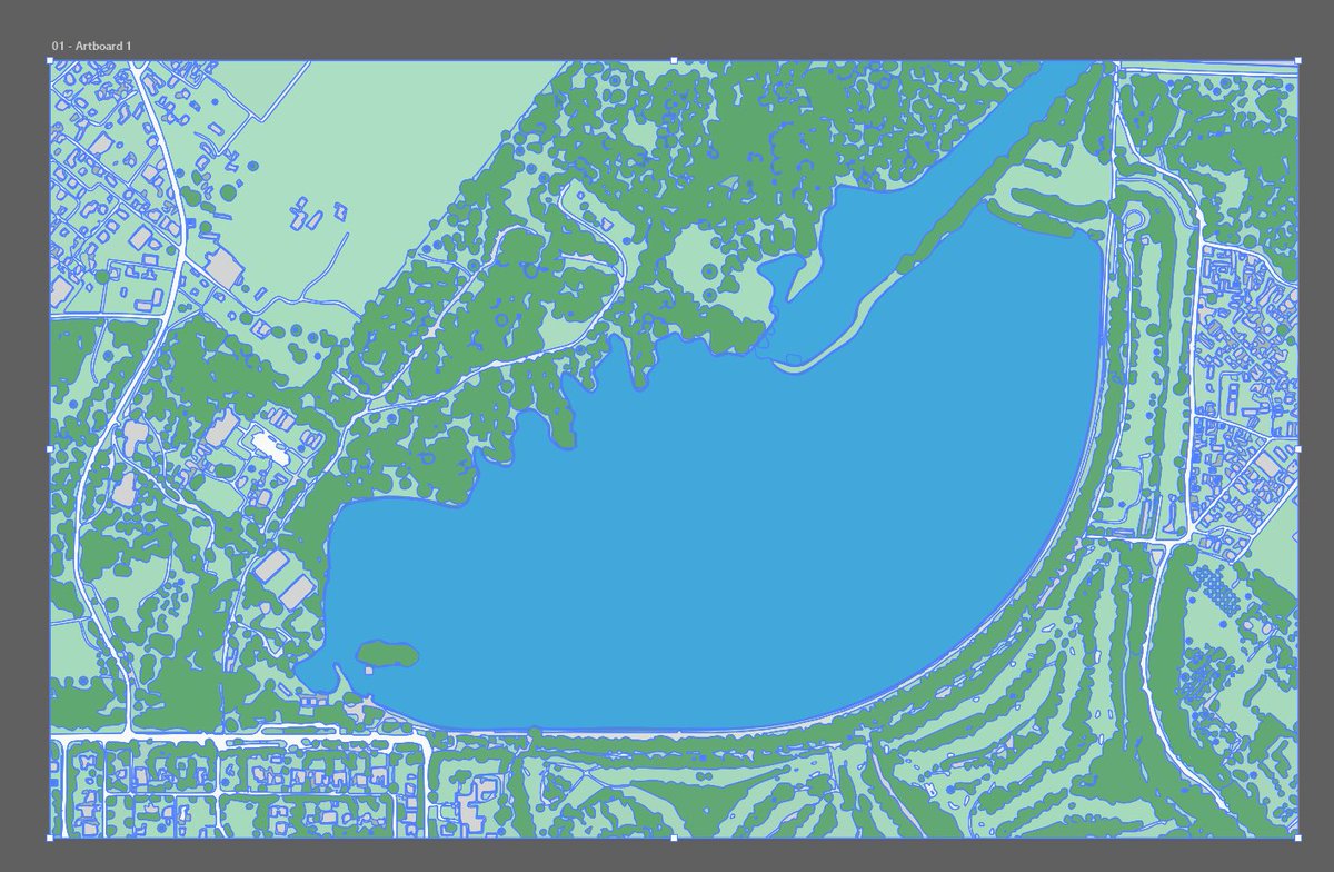
This could be a pretty cool way to generate the set dressing for maps (e.g. agricultural fields, wild forests, manicured parks). Even tried to vectorize the output in illustrator (see below).
My prompts below:
(Stylized Map)
Create a masterpiece-level hand-drawn urban planning map based on the provided satellite image. The style should merge technical accuracy with artistic cartography.
Visual Style:
Ink and watercolor wash aesthetic, but with the precision of a CAD drawing.
Vibrant but natural color palette.
Detailed Elements:
Buildings: Hand-inked outlines with a slight bevel effect for dimensionality.
Nature: Trees should be represented by individual distinct circular canopies for street trees, and textured green washes for parks.
Water: Watercolor texture blue with defined banks.
Roads: Clearly defined clean paths, varying in width based on the satellite image prominence.
Composition: High level of detail, covering all semantic classes (sidewalks, swimming pools, medians). The result should look like a finalized vector illustration ready for print.
("Vector" HD Map)
Role: Act as an expert Cartographer and GIS Specialist specializing in High-Definition (HD) vector mapping. Task: Convert the attached satellite image into a highly detailed, segmented vector-style map. The output must look like a pristine, digital map interface similar to Apple Maps or a high-end CAD site plan. Visual Style: Perspective: Strictly top-down orthographic (2D). No tilt, no camera distortion. Aesthetic: Flat vector graphics, sharp geometric edges, solid color fills, no gradients, no photographic textures. Line Work: Clean, continuous Bezier-style curves. Semantic Segmentation Rules (Color & styling): Buildings: Render as solid, neutral light-grey shapes (Hex #E5E5E5) with a very subtle, thin darker outline to define edges. Represent precise footprints. Roadways: Render as distinct white paths with varying widths corresponding to reality (Highways > Streets > Alleys). Pedestrian Areas: Render sidewalks, walkways, and trails as very light warm-grey lines, distinct from the roads. Water Bodies: Pools, ponds, and rivers should be a flat, vibrant "Map Blue." Vegetation: Lawns/Grass: A soft, pastel mint green. Trees/Canopy: Distinct, darker green circles or organic blobs placed over the grass layer to represent tree coverage. Ground/Base: A neutral background color. Granularity & Detail: Maintain strict adherence to the spatial layout. Include granular details like driveway cutouts, median strips on roads, and distinct separation between buildings and sidewalks. Negative Constraints: Do not include: Shadows cast by buildings, cars, people, clouds, photographic noise, or 3D perspective effects. The image should look like a generated vector file, not a photo filter.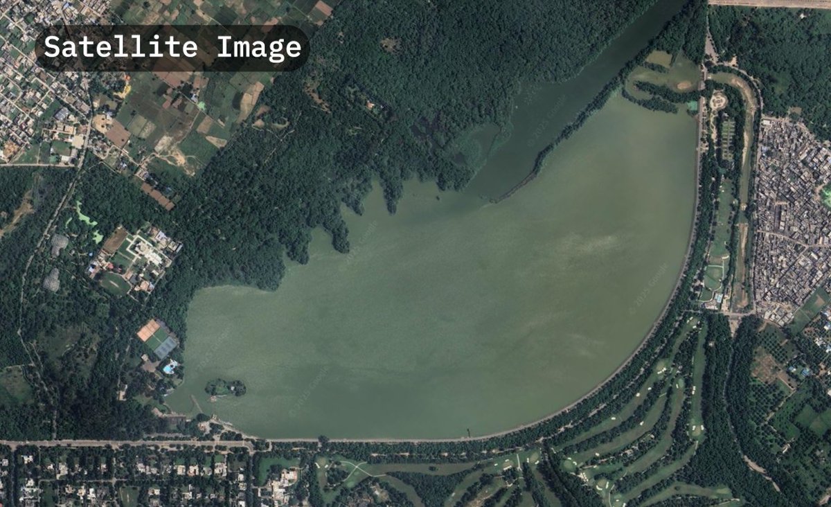
My prompts below:
(Stylized Map)
Create a masterpiece-level hand-drawn urban planning map based on the provided satellite image. The style should merge technical accuracy with artistic cartography.
Visual Style:
Ink and watercolor wash aesthetic, but with the precision of a CAD drawing.
Vibrant but natural color palette.
Detailed Elements:
Buildings: Hand-inked outlines with a slight bevel effect for dimensionality.
Nature: Trees should be represented by individual distinct circular canopies for street trees, and textured green washes for parks.
Water: Watercolor texture blue with defined banks.
Roads: Clearly defined clean paths, varying in width based on the satellite image prominence.
Composition: High level of detail, covering all semantic classes (sidewalks, swimming pools, medians). The result should look like a finalized vector illustration ready for print.
("Vector" HD Map)
Role: Act as an expert Cartographer and GIS Specialist specializing in High-Definition (HD) vector mapping. Task: Convert the attached satellite image into a highly detailed, segmented vector-style map. The output must look like a pristine, digital map interface similar to Apple Maps or a high-end CAD site plan. Visual Style: Perspective: Strictly top-down orthographic (2D). No tilt, no camera distortion. Aesthetic: Flat vector graphics, sharp geometric edges, solid color fills, no gradients, no photographic textures. Line Work: Clean, continuous Bezier-style curves. Semantic Segmentation Rules (Color & styling): Buildings: Render as solid, neutral light-grey shapes (Hex #E5E5E5) with a very subtle, thin darker outline to define edges. Represent precise footprints. Roadways: Render as distinct white paths with varying widths corresponding to reality (Highways > Streets > Alleys). Pedestrian Areas: Render sidewalks, walkways, and trails as very light warm-grey lines, distinct from the roads. Water Bodies: Pools, ponds, and rivers should be a flat, vibrant "Map Blue." Vegetation: Lawns/Grass: A soft, pastel mint green. Trees/Canopy: Distinct, darker green circles or organic blobs placed over the grass layer to represent tree coverage. Ground/Base: A neutral background color. Granularity & Detail: Maintain strict adherence to the spatial layout. Include granular details like driveway cutouts, median strips on roads, and distinct separation between buildings and sidewalks. Negative Constraints: Do not include: Shadows cast by buildings, cars, people, clouds, photographic noise, or 3D perspective effects. The image should look like a generated vector file, not a photo filter.
