@TrungTPhan: You've probably seen this vira...
@TrungTPhan
20 views
Jun 17, 2024
1
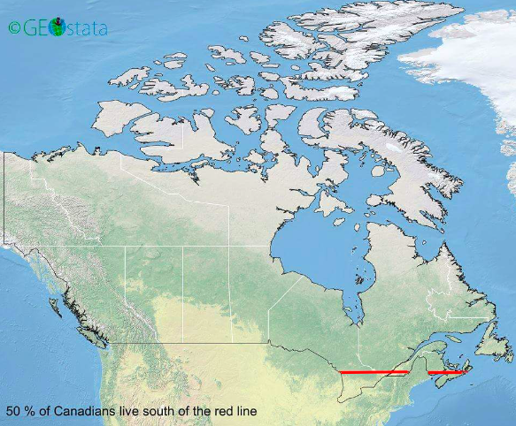
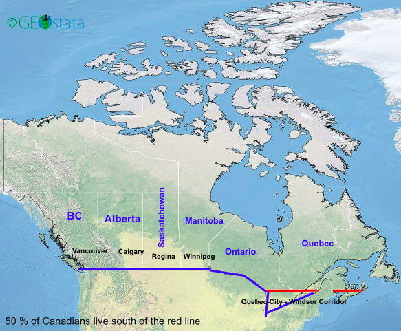
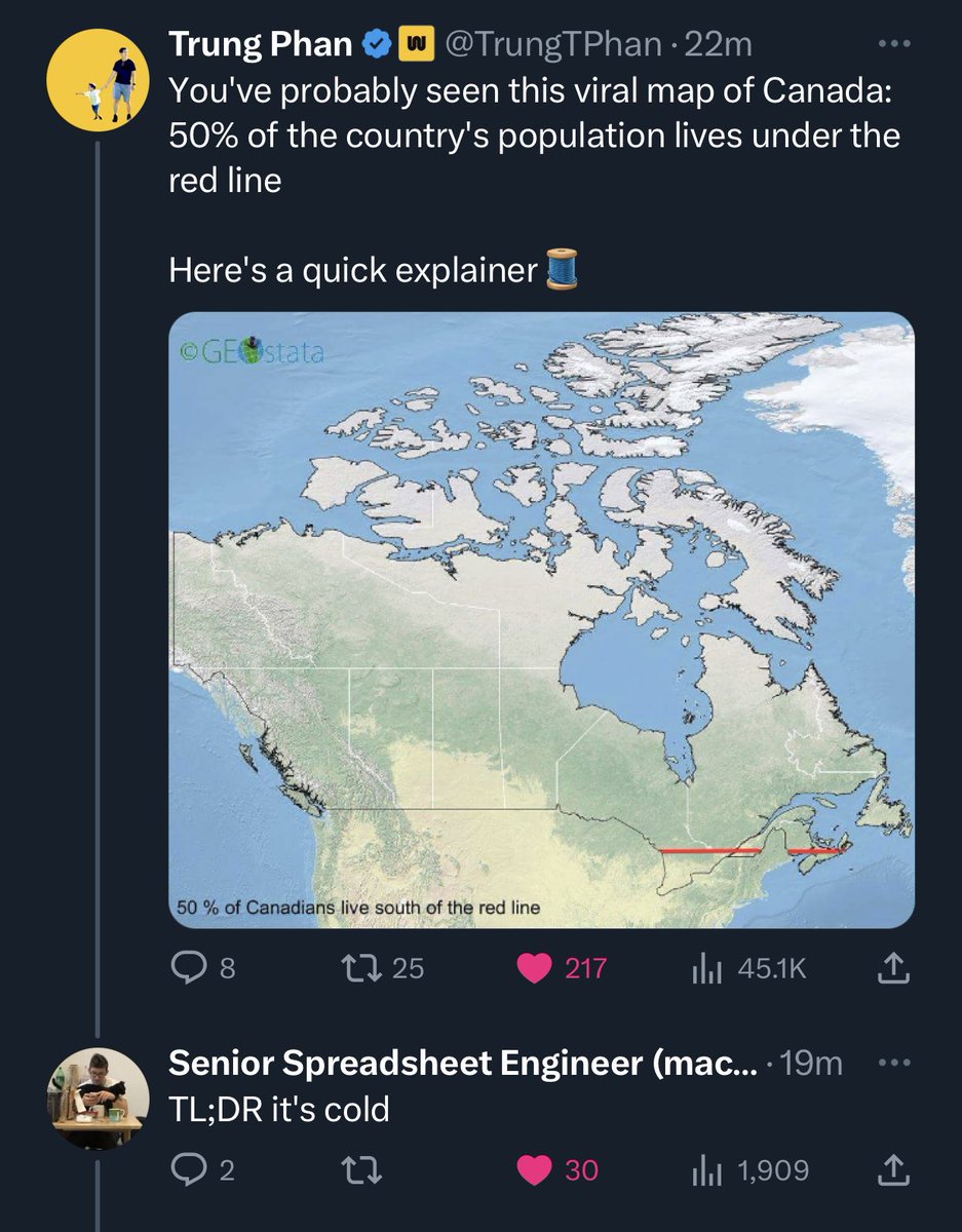
You've probably seen this viral map of Canada: 50% of the country's population lives under the red line
Here's a quick explainer🧵
Here's a quick explainer🧵
2
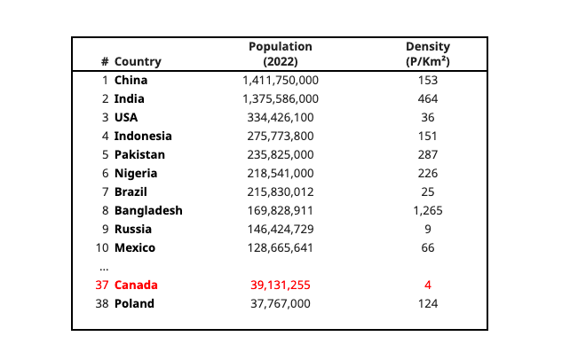
Canada is the 2nd largest country in the world by landmass (as a Canadian, this fun fact was oft-repeated in elementary school):
1. Russia (17 million Km²)
2. Canada (10 million Km²)
3. USA (9.8 million Km²)
4. China (9.6 million Km²)
5. Brazil (8.5 million Km²)
1. Russia (17 million Km²)
2. Canada (10 million Km²)
3. USA (9.8 million Km²)
4. China (9.6 million Km²)
5. Brazil (8.5 million Km²)
3
But Canada is only the 37th most-populous country in the world. And it has a very low population density (at 39m people, Canada has about the same population as California).
4
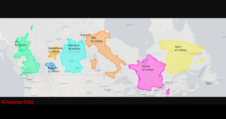
Here is a map with the land masses for the UK, Netherlands, Belgium, Italy, France and Spain all fitting inside Canada.
Those European countries have a combined 352 million people, nearly 10x Canada's population.
Those European countries have a combined 352 million people, nearly 10x Canada's population.
5
Why is Canada so sparsely populated?
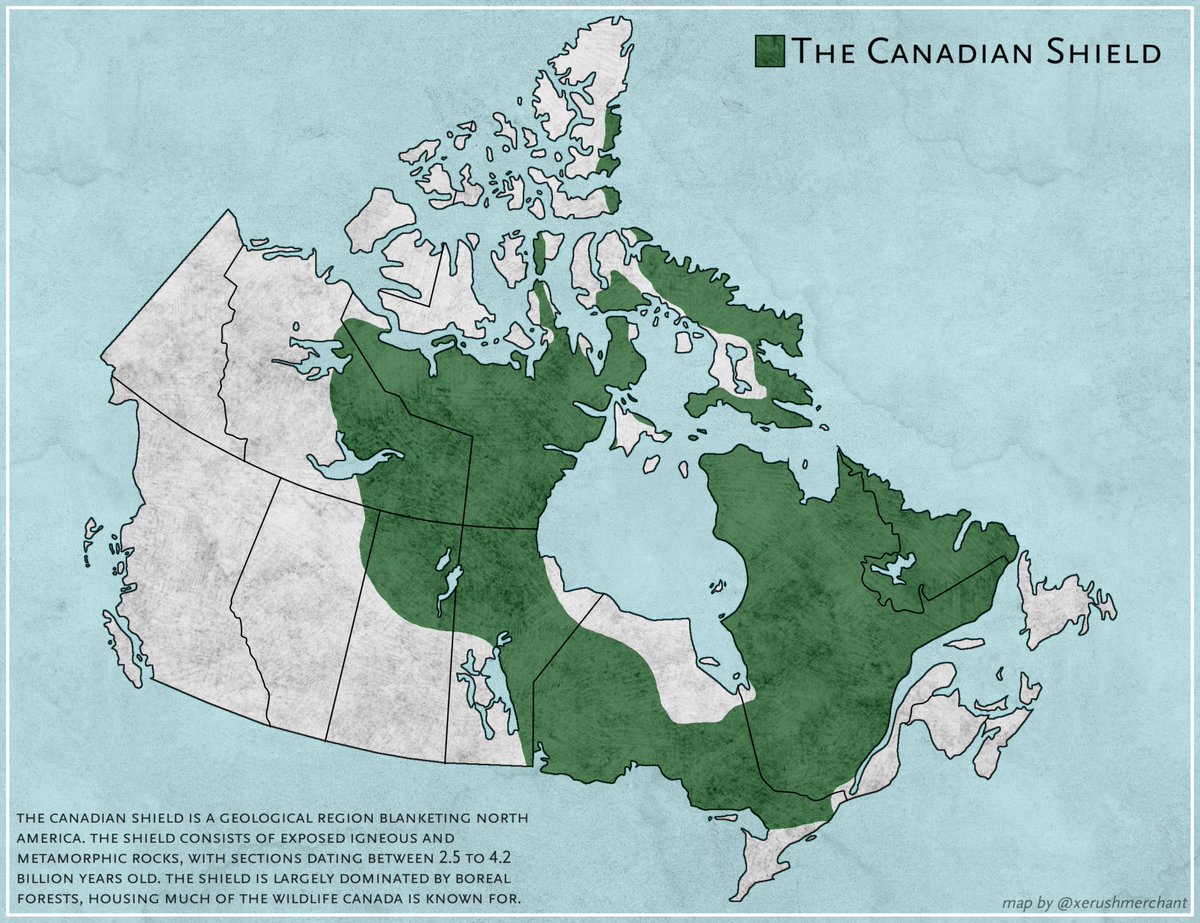
Because most of the country's landmass is largely uninhabitable: 8 million Km² is made up of The Canadian Shield, a large area of exposed rock with very little top soil.
And that little soil is usually frozen from long winters.
Because most of the country's landmass is largely uninhabitable: 8 million Km² is made up of The Canadian Shield, a large area of exposed rock with very little top soil.
And that little soil is usually frozen from long winters.
6
Now, let's go back to the 1500s.
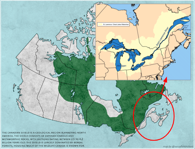
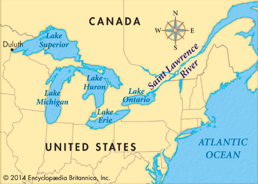
When European explorers — in this case France — crossed the Atlantic, they entered what is now the Canadian land mass through the St. Lawrence Seaway, one of world's largest and deepest estuaries.
When European explorers — in this case France — crossed the Atlantic, they entered what is now the Canadian land mass through the St. Lawrence Seaway, one of world's largest and deepest estuaries.
7
In the following centuries, English explorers also went through the St. Lawrence.
The colonial powers established settlements in Quebec and then Ontario. Crucially, land in the region — particularly near The Great Lakes — is very fertile (especially vs. The Canadian Shield).
The colonial powers established settlements in Quebec and then Ontario. Crucially, land in the region — particularly near The Great Lakes — is very fertile (especially vs. The Canadian Shield).
8
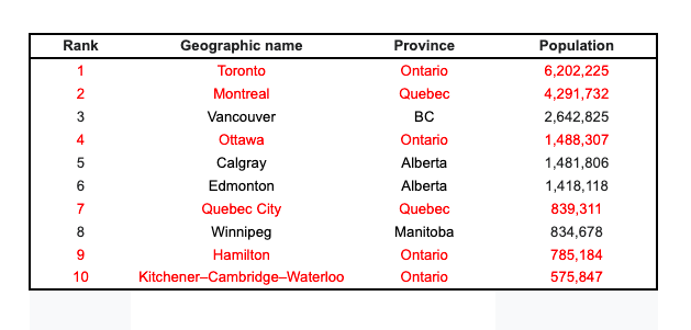
While Canada expanded West in late-1800s and early-1900s (Saskatchewan, Manitoba, Alberta, BC), population centers around Toronto and Montreal remain the largest.
Also, metropolitan areas around Toronto, Montreal and Ottawa and Quebec are 1/3rd of the country's population.
Also, metropolitan areas around Toronto, Montreal and Ottawa and Quebec are 1/3rd of the country's population.
9
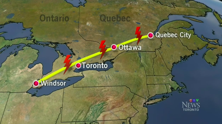
Now, add up *all* the population centres from Quebec City, Quebec to Windsor, Ontario (it's known as the Quebec City-Windsor Corridor and is 1,150km long).
This region tracks to the European St.Lawrence sailing path and contains 50% of Canada's current population.
This region tracks to the European St.Lawrence sailing path and contains 50% of Canada's current population.
10
So, ~50% of Canada's population is concentrated under the red line (Quebec-City - Windsor Corridor). And the major population centres in the West are near the US border.
One last fun fact: 85%+ of Canada's entire population lives within 160km (or 100 miles) of the US border.
One last fun fact: 85%+ of Canada's entire population lives within 160km (or 100 miles) of the US border.
11
If you enjoyed that, follow me — a very Canadian dude — for other interesting threads. And subscribe to my business newsletter including previous issues on:
• Why is Linkedin so cringe?
• The worst tech predictions ever
• Psychology of Apple packaging
trungphan.substack.com
• Why is Linkedin so cringe?
• The worst tech predictions ever
• Psychology of Apple packaging
trungphan.substack.com
12
PS. If you’re like me and consume a ton of content, check out my AI-powered research app Bearly.AI that boosts:
• Reading (instant summaries)
• Writing (rewording, grammar correction, auto-generated text)
• My dopamine levels on every sign-up
Try it free:
• Reading (instant summaries)
• Writing (rewording, grammar correction, auto-generated text)
• My dopamine levels on every sign-up
Try it free:
13
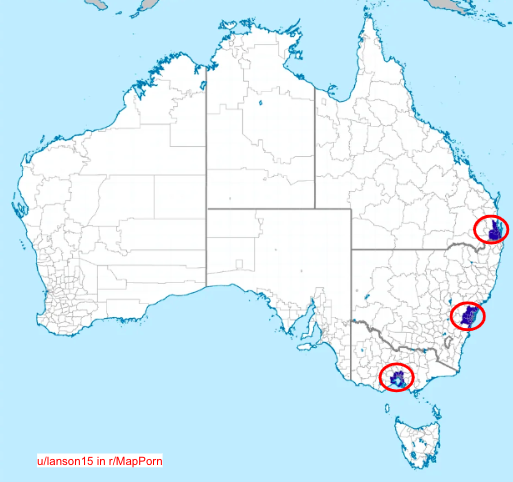
Australia has a similarly interesting map: 50% of the country's population lives in these three major centres (Melbourne, Sydney, Brisbane).
In fact, Australia's population (3.4 people per Km²) is among the world's lowest and less dense than Canada (4 people per Km²).
In fact, Australia's population (3.4 people per Km²) is among the world's lowest and less dense than Canada (4 people per Km²).
14
15
Credit to @DaniMermelstein for completely wrecking me lol
16
Creddit to Ross for wrecking me for fixating on the Quebec City-Windsor Corridor and ignoring Nova Scotia
View Tweet