Thread Truncated (Cap Enforced)
Only the first 20 tweets are unrolled into slides to ensure reliable PDF exporting and high server performance.
Canvas & Ratio
Choose your destination platform format
Layout Template
Choose a content structure for your slides
Preset Themes
Typography & Sizing
Brand Kit Customization
AGENCYConfigure brand assets for headers & footers
Outro Slide CTA
Customize your closing call-to-action slide
Background Pattern
Build Your Carousel
Drag and drop any post card below onto a slide, or use the quick buttons to insert content/images instantly!

We discussed India's 1.4B people earlier this week, but China also has 1.4B ppl Why? Is it a coincidence these 2 population giants are neighbors? Why do most of its 1.4B ppl live east of the red line? It's also due to an accident:
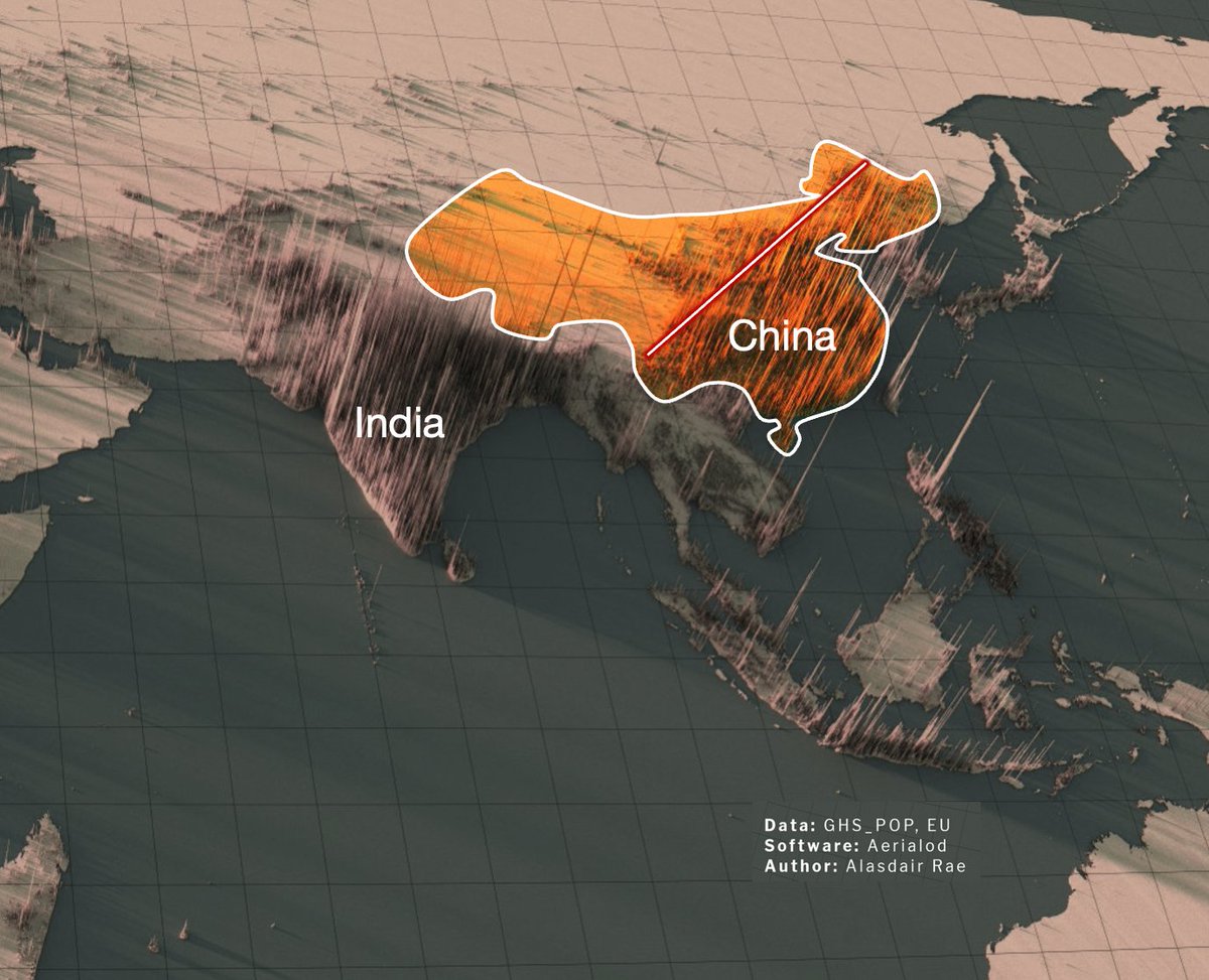
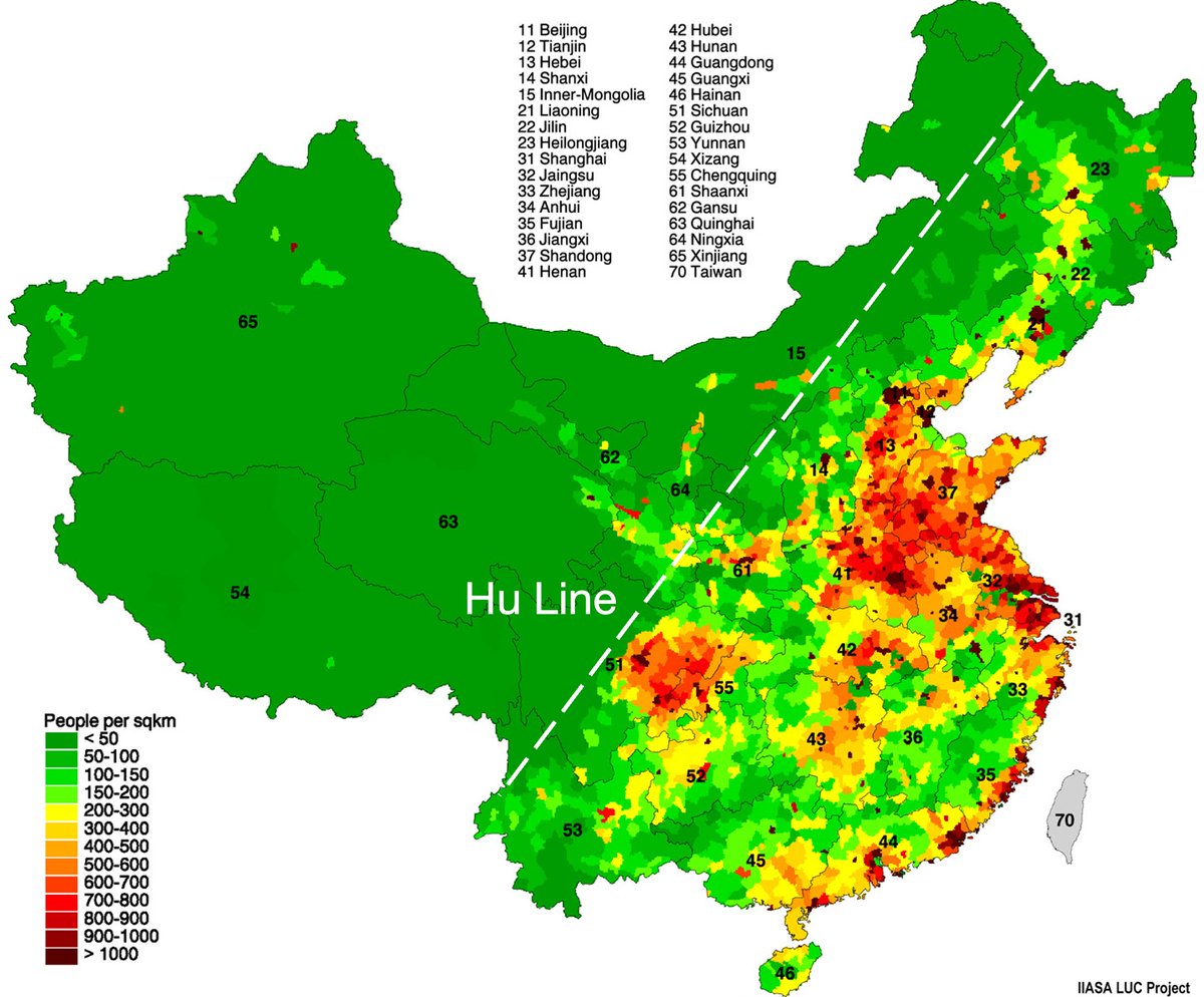
Let's zoom in 94% of Chinese live east of the Hu Line! • In the North China Plain, the red area in the northeast • The Sichuan Basin, that red circle in the middle • Small dots along the coast • The regions between these 3 Why?
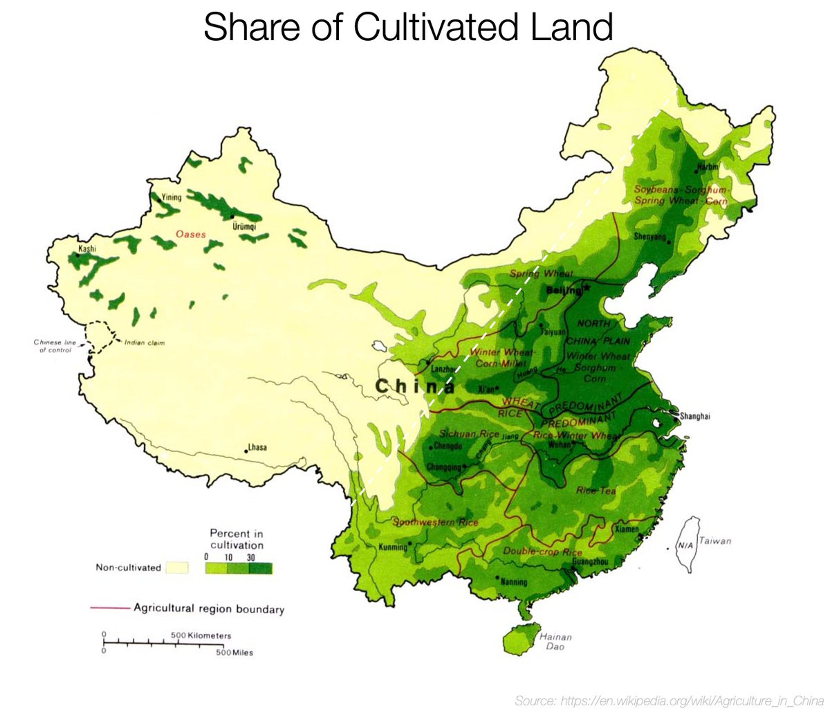
Let's look at China's topography. Does something pop out? Ppl are where it's flat Flat➡️+ppl Mountains➡️-ppl Why? Because of food.

Fertile soil = 🌱=🧑🤝🧑 The more fertile, the more food, the more ppl. So why are these areas so fertile?
Plants grow with 3 ingredients: 1. Water 2. Heat 3. Fertile soil To have so many ppl, you need all 3 to be perfect. So how does China have these perfect conditions? 1st, water:
These are the main rivers of China. The Yangtze and Yellow rivers are the longest in Asia, and Yangtze's discharge is only 2nd to the Ganges' Both of them reach the sea through the North China Plain. The Yangtze also serves the Sichuan Basin. That makes them hyper fertile!

Such huge rivers on flat plains frequently flooded, bringing their sediments (=fertile soils) to the region.

Another benefit of flat plains: ppl can +easily build canals for trade & irrigation. The Chinese have been building them for thousands of years! The Chinese Grand Canal connects the Yellow & Yangtze rivers and was started over 2500y ago!

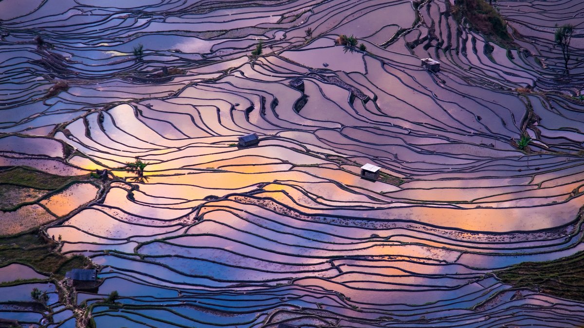
The result is that the North China Plain and the Sichuan basin have flat, well irrigated, well fertilized land—and wherever it's slightly hilly, it has been terraced
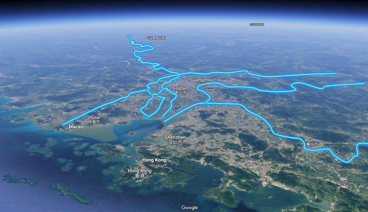
The Pearl River delta serves Hong Kong, Macao, Shenzhen and Ghuangzhou, which together have a bigger population than Germany
And where do these 3 rivers start? In Tibet and the other mountain ranges caused by the collision between the Indo-Australian and Eurasian plates!

As we saw in the thread about India, these mountain ranges catch all the rains coming from the monsoon, which become rivers like the Ganges, but also like the Yellow, Yangtze, and Pearl rivers! <a target="_blank" href="https://twitter.com/tomaspueyo/status/1622753378265694210" color="blue">x.com/tomaspueyo/sta…</a>
But most of the water they catch is not from the Indian monsoon... It's from the Chinese monsoon! This map shows rains in China. You can see the Hu Line ~between green and yellow! Why is this the extent that rains reach?

Because the moist wind comes from the Pacific & South China Sea, and travels towards Eurasia until it's stopped by mountains.
This is the same process as in India. In summer: • The hot ocean air fills with moisture • But land air heats faster, so it goes up • The vacuum is filled with sea air • Which empties its water on the land • And mountains condense all remaining water from the wind

But the South China Sea and Pacific are farther north than the Indian ocean. How come that air is still warm enough for a monsoon? Because warm sea water comes from the warmer south!
And why is that? Because of the rotation of the Earth, causing the winds and ocean gyres

OK so now we know why China is: 🌡️Hot: It's reasonably south + bathed by warm waters thanks to the Earth's rotation 🌧️Humid: Monsoons come from the warm sea, rain on the east until they reach the mountains, and drop the rest of water, which becomes rivers
🌱Fertile soil: The rivers bring sediments and water, good for irrigation ➖Flat, which helps for dropping sediments, easier irrigation, and easier farming But why is it so flat?
Part of it is rains and rivers carving the soil and dropping sediments for millions of years. But part of it is... Tectonic plates! The Pacific Plate is going below the Eurasian Plate, and as it does, it flattens the surface!
